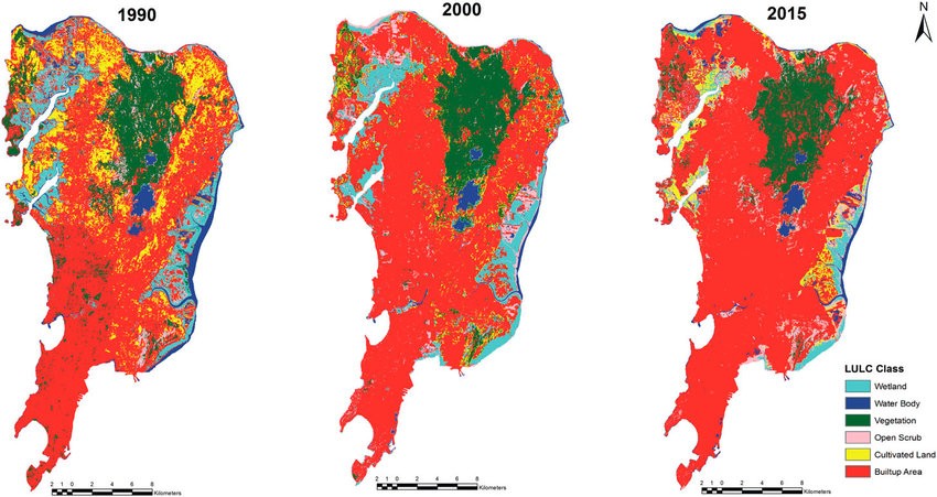
This project analyzes Land Use Land Cover (LULC) changes in Mumbai and Satara regions using Google Earth Engine and QGIS (MOLUSCE), leveraging Landsat-8 and Sentinel-5P data. Advanced hybrid deep learning models such as MLP+LSTM and CNN+MLP were applied for LULC classification and future land cover prediction. SHAP values were utilized to interpret the impact of LULC features on environmental outcomes. To forecast air quality, a GRU+GCN model was developed to estimate AQI from 2017 to 2035 using key pollutants (SO₂, NO₂, PM₂.₅, PM₁₀), with LIME offering interpretability. Further, diphtheria risk was predicted based on pollutant exposure using Composite-Kernel Gaussian Process Regression (GPR).
The study highlights significant urban expansion and environmental degradation by 2025, emphasizing the importance of sustainable land management and the integration of geospatial and AI techniques for informed policymaking.